Napa River (Crossroads Yountville)
Napa River Ecological Reserve,
Napa County Parks/California Department of Fish & Game,
Napa County
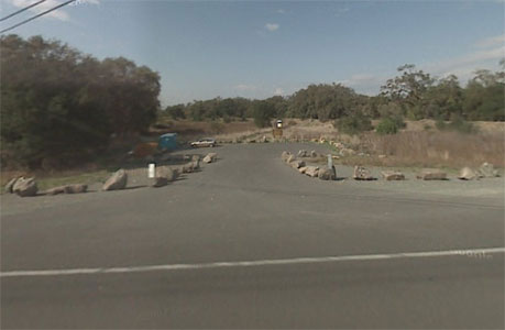
- Location:
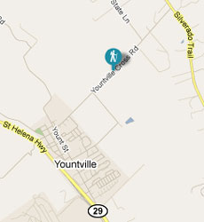
- Yountville Cross Roads - Between Hwy 29 and Silverado Trail in Yountville
- Entrance is by the Bridge
- Not Accessable during winter months: Typically Dec - April
- 1 mile loop in a tiny preserve along the Napa River, where trails squeeze through a jungle of vegetation in summer
- Rules: Open sunrise to sunset. Single trail is hiking only. Dogs are permitted on leash.
Tall valley and coast live oaks rise up from a dense understory of blackberry, poison oak, coyote brush, wild rose, and snowberry. The narrow trail winds at a level grade along the edge of a grassy meadow, then heads into a more shaded area. Leaves of wild grape vines dangle from trees at a profusion rivaling poison oak. Wild plum trees seem to flourish everywhere along the trail, along with a few ash, buckeye, and walnut trees. Near a bench the trail curves left and weaves through some California bays. Gradually the trail veers left again, adopting a course along the river.
A few paths head right to the banks, though it's a scramble to reach the water (watch out for poison oak if you give it a try). When I visited in September there was a depressing amount of garbage on both sides of the river. The trail pops out of the woods to bisect a small grassy area with a few soaring valley oaks. After another stretch through bays, the trail skirts the far side of the large meadow, then emerges, at 0.90 mile back at the previously encountered junction. Turn right and retrace your steps back to the trailhead.
Total distance
: 1.03 miles
According to a pamphlet published by the Napa-Solano Audubon Society, the Napa River Ecological Reserve "has become an important habitat for many species of birds and other wildlife." It's no wonder, for the 73 acre parcel has just about everything wild animals need: abundant cover, food, and water. Valley and coast live oaks, California bay, willow, and thickets of shrubs shelter birds, an astounding variety of wild berries, nuts, and fruits feed birds, small mammals, and even a host of butterflies, and the Napa River holds water all year round. Since the reserve is a floodplain, you'll need to plan a visit during the drier months of the year. When the river is full there is no route across the waterway, and access to the reserve's single trail is blocked.
|
 |
Begin at the edge of the parking lot on a path through a meadow. There areinterpretive displays about the reserve's history and ecology on the left. Look for maps on the second panel, although there were none on my visit. Chicory blooms in the grass during summer months. After about 300 feet, the path climbs onto the banks of a levee and splits at an unsigned junction. Bear right. After descending slightly, bear left and walk along the rocky ledge along the river. Willows block a view to the water, and you must search through the tangle of vegetation on the right for a path to the shoreline. There is no formal bridge, but tree branches facilitate a crossing. On the other side of the river, the trail picks up again, ascending to an undersigned junction at 0.13 mile. Stay to the right. A short spur on the right visits the first post on a self-guided tour.
|
|